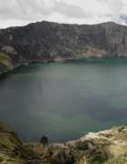
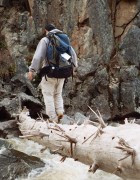
Ecuador Highs

26 09 2010

Ecuador is considered an outdoor enthusiasts paradise. The country boasts the jungles of the Amazon, mountains of the Andes, coastline of the Pacific, and the islands of the Galapagos. Naturally, it is a country well-suited to my interests. Unfortunately, with only 2 weeks planned, Jillian and I decided it was unrealistic to tackle all Ecuador has to offer. We chose to set our sights mainly on the highlands area of the Andes with the Quilotoa Loop as our focal point. Quilotoa Lake is a volcanic crater lake high in the Andes. The loop is a 200 km (125 mi) circuit of connecting towns around the lake. These towns are home to the indigenous mountain-folk – mainly Quichua. The loop has become a big draw with backpackers and rightfully so. The views are stunning and the culture and friendliness of the indigenous people are refreshing. The appeal for backpackers is the combination and flexibility of using your legs, horseback, and local buses and trucks to make your way around the loop. Lonely Planet described the Quilotoa Loop as, “One of the most mind-altering trips in all the Andes.” I’m pretty sure Lonely Planet wasn’t referring to drugs.

Jillian and I flew into Quito. Because of a delay in Houston, we didn’t land in Quito until 2am. We overpaid for a cab (knowingly, but at 2am, I didn’t have the patience to negotiate over $10). The cab ran every red light on its way to our hostel, Secret Garden. It was perfectly safe since at that time there are very few cars on the roads, but this was clearly the normal practice. We crashed (no, not the car…) immediately after arriving. After some much needed rest, we woke the next morning and headed to the rooftop terrace for breakfast. The beautiful view of Quito greeted us as we ate our breakfast.

view from Secret Garden rooftop

We met an avid climber Eric, from Canada but living in Baltimore, and spent the day exploring Quito together. Being designated an UNESCO site, Quito is filled with historic buildings. My favorite was certainly Basilica del Voto National.

basilica

You can (and we did) climb the hundreds of stairs and ladder steps into the highest steeple tower. Certainly not for those fearful of heights.

Jillian climbing the steep steps!

The next day, we took two local buses, first to Latacunga then Zumbahua as we began our journey on the Quilotoa Loop. We chose to do the loop clockwise though it can be done just as easily counterclockwise. Zumbahua is actually one of the bigger towns on the loop, yet one can walk through the town center area in under five minutes. We bought some papas fritas (french fries) from a street vendor and it came topped with chopped onions and a fried egg. As night approached, we saw the locals starting to set up in the central plaza for a market.

lady I bought papas fritas from

I lent a hand to a little boy who was trying to move a couple table pieces clearly too heavy for him. With not much else to do, Jillian and I played a couple games of war, which lasted all of 20 minutes as Jillian crushed me. It was ridiculous and probably the fastest two games of war in history. At 12,500 ft and no heat, we bundled up and went to bed. Starting around 4am, I began to hear loud festive music blaring but was too stubborn to give up on sleeping. Finally, we got up at 7am and when we looked out the window, we were shocked to see hundreds of people and market goods already in full swing. We walked through the market and bought some fruit before starting our hike to Quilotoa.

Zumbahua market

Quilotoa, where Quilotoa Lake is (obvious right; well maybe not always…after all, the Kansas City we all think of is in MO and not KN), is about 8.5 miles from Zumbahua. Though one could easily hitch a ride from the numerous trucks passing by for a few dollars, we had our mind set on doing this part of the loop by foot. The scenery was wonderful and we waved and said “hola” to the village folk we saw. The road was straightforward and we were feeling great until the last 2 km when the road became a seemingly endless uphill trek. As we rounded each turn, another uphill greeted us. With our packs feeling heavier with each step, we finally reached Quilotoa. We quickly found a hostel and rested for a bit before heading up the road without our packs (thank goodness) to see Lake Quilotoa. The sight I’d been eager to see for 3 months came into view and it was more beautiful than any picture I had seen or image I had imagined.

Quilotoa Lake during the midday

Quilotoa Lake in the early morning

We took it all in then headed back to the hostel to save our energy to hike down to the lake tomorrow. Though only slightly higher than Zumbahua, Quilotoa was cold! The Andean air just made everything seem colder, but dinnertime was warm thanks to the fireplace in the room. As the hostel served authentic food, it was fun mingling with all the other travelers from many different countries. We all sat around these long wooden tables and it truly felt like a mini-family. That night, a wicked headache hit me for the second straight night. I don’t know if it was the lack of sleep from the nights before, the altitude, the cold, or what, but I barely slept and felt like crap in the morning. Luckily, after some breakfast, I began to feel better and as we readied to hike down to the lake, I felt ok. With our German buddy Christian, we hiked down to the lake. It’s quite a steep descent of roughly 1000 feet and we were dreading the inevitable hike back up. But, we put it aside for now and enjoyed the amazing scenery. At the bottom, we rented kayaks and paddled out onto the lake. Paddling on a volcanic crater lake, and for $1.50, how awesome is that?!? Unfortunately after paddling, the hike back up was upon us. Steepness combined with nearly 13,000 ft meant slow going. After reaching the top, we ate a well-deserved lunch including hot chocolate!

Tired from hiking down and up the lake, we had no interest of hiking the 9 or so miles to the next town of Chugchilan, so we hired a local guy to take the three of us to Chugchilan in the back of his truck for $15. It turned out to be an exhilarating “rollercoaster ride” as Jillian described it. Along the unpaved roads, the ride was filled with all the jostling bumps a kid could ask for. There are three great lodging options in Chugchilan – Black Sheep Inn, Mama Hilda’s, and Cloud Forest. Black Sheep Inn is a celebrated eco-lodge, but also far pricier than the others. We’d read great things about Cloud Forest and decided to stay there. It did not disappoint. The food was good, the staff friendly, and they had hot water allowing us to take our first hot shower since we’d arrived in Ecuador!

The next day, Christian, Jillian, and I took a horseback riding tour to visit a cheese factory, a waterfall, and a cloud forest. All were cool, and the scenery was breathtaking! I’m talking about amazingly green Andean mountains hundreds of feet above and below us.

scenery while horseback riding

Plus, the horseback riding was quite the experience. None of us being accomplished riders (though Christian had some decent experience in Germany), we all found it quite tiring. This was no beginner’s riding tour. We were full on galloping up and down hundreds of steep meters. At the end of the 5-hour tour (yep, 5 hours), though completely accident free, we were beat up! Our knees were SO sore from being slightly bent for that long and my butt was sore as hell too!

The next day, we planned to take the (in)famous milk truck to the town of Sigchos before catching a local bus back to Latacunga. Instead, some of our new friends at the hostel told us they met two telephone workers who were doing a job in the area and were heading back to Quito at noon. They had offered to drop them off in Latacunga along the way. Our friends had nicely asked for us if we could jump in as well. But our noon departure turned to 1 then 2. By 3, we were seriously doubting if they were going to show up. This was especially annoying since it rains like clockwork in this part of the Andes everyday around 3. Finally, at just after 3, their red pickup pulls up and of course it had just started to rain. Since we had seven people and could only cram four into the truck, Christian, Dean (from Utah), and yours truly volunteered to ride in the bed partly cause we all had good rain jackets (thanks KaBOOM!). Using a plastic sheet to cover our bags, we braved the cold and rain for the 3-hour ride to Latacunga. Luckily, the second half of the ride was rain-free and we actually ended up quite dry. And in a way, it was a blessing in disguise as we got to experience the sights and sounds of the Andes on the outside instead of being locked inside the truck. In Latacunga, Jillian and I said goodbye to our friends except for Christian since he was heading in the same direction as us the next day.

The next morning, we parted ways with Christian and made our way to Banos. At about 6,000 feet, we felt like we had cardio for days! Banos is famous for its thermal paths and its adventure activities. You can do everything from bungee jumping to rafting to rock climbing and ATVing. Banos sits at the base of the active Tungurahua Volcano. Banos has been evacuated in the past due to volcanic activity, but the people always come back. We stayed in Banos for three days and did two activities – canyoning (rappelling down waterfalls) and a jungle tour. The canyoning was a blast; Jillian especially loved it.

Jillian rappelling...

and loving it!

The first few rappels were down moderate falls, but the last one I estimated to be about 100 ft! The face was caved in too, which meant no contact with the rock with our feet, which was pretty fun.

me rappelling

The jungle tour was an all day tour that took us past waterfalls, a monkey park where the monkeys climbed all over us, and into the outskirts of the Amazon area. We visited a local village, rode down a river in a dugout canoe, and hiked through the jungle to a pretty waterfall that we could swim in. We also had the chance to eat some jungle plants, ants, and termites thanks to our knowledgeable guide Carlos.

Jillian and her friend

my jungle ink

Jillian's jungle ink

waterfall we hiked to and swam in


After Banos, we made our way back north towards Quito stopping in the town of Machachi. We stayed at the wonderful Hosteria Papagayo. Nice cabin-type rooms with good food and our own fireplace! Back up over 10,000 feet, the fireplace was great. We joined the hostel’s Bike Cotopaxi tour the next morning. Cotopaxi is the second highest peak in Ecuador at 19,347 ft and an active volcano (Ecuador is littered with volcanoes). The tour bus took us through the vast expanse of the Cotopaxi area and all the way up to 14,650 ft. From there, we hiked up to the climber’s refuge at 15,780 ft where those seeking the summit crash.

proof of our climb to the refuge!

Though less than a mile distance, the approximately 1000 ft elevation gain at that altitude made for a 45 minute endeavor. We rested up for a bit at the refuge before making one more push to 16,400 ft where we reached the glacier/snow line part of Cotopaxi. Upon reaching the glacier, Jillian uttered her last words, “Never again.”

at the Cotopaxi placier

Ok, so they weren’t really her last words, but I can safely say that they were the last time she will say those words at that altitude. We returned to the refuge where an amazing lunch awaited us. Tuna salad, cheese and crackers, guacamole, soup…simple but delicious!

After lunch, we made our way back down to the bus where we hopped on our bikes and headed down. Fast and slippery due to the volcanic rock/ash, I thought it was pretty fun. Jillian found it a little uncomfortable and scary, but she toughed it out and made it down. Tired after a day of fun, I slept on the bus ride back to the hostel. That afternoon, we caught a bus back to Quito and checked into Hostel Belmont, which was right by Secret Garden but cheaper.

We spent our last couple days in Quito buying some gifts and exploring the city some more including taking the teleferico (cable car) high up to the mountains looking down on the city.

doggy at top of the teleferico

The teleferico is a touristy attraction and there’s even a small amusement park there. Both of us loving rollercoaster type rides, we had to go on a couple, and it was so fun! Our flight home was at sunrise, so we left our hostel in the dead of night and rode to the airport just as we’d arrived…running red lights :-)


The Charms of Kauai

2 06 2010

With all the traveling I’ve done including 41 of the 50 states, it was always surprising (and slightly embarrassing) to me that Hawaii and Alaska were two of the 9 remaining unchecked states. But, as I type this, I now stand at 42 with a check mark next to Hawaii! Through Jillian’s timeshare with her sister, I was fortunate enough to be able to explore the beautiful island of Kauai with Jillian, her sister Jaime and boyfriend Sean, and her Aunt Dina and Uncle Phil.

Day 1
Kauai is perhaps best known for the stunning Na Pali Coast. This was certainly one of the main sights I was looking forward to. The famed Kalalau Trail meanders 11 miles one way along the coast beginning at Ke’e Beach ending at Kalalau Beach. Many do the 22-mile roundtrip camping along the beautiful beaches. How awesome that would be! Given the timeshare, this obviously wasn’t our itinerary. Our plan was to hike the popular two miles to Hanakapi’ai Beach (technically, a permit is needed beyond this point anyway). Being an avid hiker, I had read much about the trail and knew there was an additional 2-mile side trail from Hanakapi’ai Beach to a waterfall by the same name. This would mean a potential 8-mile roundtrip hike or at least a 4-mile roundtrip to the beach and back. I packed a couple waters and some snacks, but generally everyone went really lightly.

Within 15 minutes, we were already starting to get views of the breathtaking coast.

Na Pali Coast

The weather was perfect too – clear and sunny but not too hot. The trail was basically well packed dirt most of the way. After many gorgeous overlooks including one really windy one that took Phil’s visor (don’t worry, I’m pretty sure he has hundreds), we arrived at Hanakapi’ai Beach. We relaxed and had a couple beers since Sean was a genius and packed some Bud Lights from the fridge :-) We deliberated for a bit about whether we wanted to go on to the waterfall. If you know me, I’m sure you know my vote. Much to my happiness, everyone was a trooper and was game to continue.

The hike to the waterfall was more rugged than the main trail to be beach as it’s rockier for one, but it also gets less traffic. On top of that, it’s wetter, and therefore muddier as you head into the forest. On the plus side, the hike was more fun as we passed lots of bamboo and the trail offered lots of little stream crossings and rock hopping.

stream crossing...Jaime looks terrified

After a couple hours, we reached the base of Hanakapi’ai Falls. Most of what I read is that the part of the falls visible from the bottom is about 300 feet.

Hanakapi'ai Falls

It’s certainly a cascading fall as its broken up at several points on its descent to the pretty pool at the bottom. Because of its cascading nature, the water comes down calmly enough for you to swim safely under it. I was excited to dive in and swim. I dove in and the plan to swim under it changed immediately as the rush of FREEZING cold water took my breath away.

diving in!

It may rank as the coldest water I’ve ever been in. There was probably, as George Costanza once said, “severe shrinkage.” We started back and everyone was feeling quite good until the last mile or so. Since we hadn’t packed much food, everyone was getting a bit tired. Sean had one more caffeine energy-boosting “magic bean” and suggested it to Dina since she seemed to be in the roughest shape. Dina tried to pass it off, but when we heard her raspy, barely audible, “You have it…,” we all sternly agreed with a good laugh that Dina should in fact eat it. Finally, we made it back and all enjoyed a well deserved dinner of Mexican food.

Day 2
The day began with some clouds and a slight drizzle but cleared up later on. We would discover this to be a recurring theme. Apparently, the northern coast of Kauai gets considerably more rain than the southern coast. In fact, according to a wikipedia source:

“Mount Waialeale on the island of Kauaʻi in the Hawaiian Islands averages more than 38 feet, 4 inches (460 inches) (11,680 mm) of rain over the last 32 years, with a record 683 inches (17,340 mm) in 1982. Its summit is considered one of the rainiest spots on earth. It has been promoted in tourist literature for many years as the wettest spot in the world.”

Jaime and Sean had booked a helicopter tour (Jack Harter offering the only no door ride!) so the rest of us dropped them off and explored some more waterfalls and scenery around the Wailua Valley area, which was very pretty. Our crew reconvened after Jaime and Sean barely survived their tour (not really, but they did say it was the scariest thing they’d ever done), and we decided to go snorkeling at Tunnels Beach.

Tunnels Beach with Sean ready to snorkel

Tunnels is well known for it’s snorkeling, but unfortunately I didn’t see much that day. However, we did see several sea turtles very close to the shore swimming and popping out their heads occasionally as we walked along the beach! The strong wind made it feel much colder cutting short our time there. But apparently, it wasn’t windy just around the bend where we were as another person told us he was “baking” there as we were packing up. I think he purposely waited til we were leaving…

Day 3
This was ziplining day! Though it was cloudy, we didn’t get much actual rain, which was great. I was definitely excited but having done it once before, I think Jillian, Sean, and Jaime were more excited. We chose the one at Princeville Ranch since it offered the most ziplines (9) along with a nice swimming spot along the way. After the first couple lines, everyone seemed very comfortable and really started to enjoy the scenery as we zipped along.

Jaime zipping!

The swimming hole right before the last line was nice and much warmer than the water at Hanakapi’ai Falls. There was a small 10-foot spot to jump off where I tested my backflip skills for the first time in quite a while. Fortunately, I landed them cleanly. After the dip and some lunch, we re-harnessed for the last line of the day. KING KONG!!! All 1,200 feet of him complete with a motorized gorilla trying to grab you as you zipped by! That second part isn’t true, but the 1,200 feet is. King Kong is a double-zip so you can race someone!

two guides on King Kong attempting a heart

Naturally, I raced Jillian and smashed her! I got a much better start. You can’t teach that reaction time! Ok, ok, I did win, but it was close. My extra 40 pounds probably played a part too.

Day 4
This was our planned kayaking day. Unfortunately, it was also the rainiest and maybe coolest day of our trip thus far. We got going early in the morning, and I simply couldn’t get myself warm. Oh well…I figured I’d warm up once we started paddling. But, it started to pour as we started up the Hanalei River. It wasn’t cold rain, but since I’d never warmed up in the first place, I just felt colder. Our main guide Henry shared a lot of cool info about the plants and surroundings around Hanalei Bay “and what not.” After maybe a 1/2 mile or so, we turned around and headed back downriver “and what not” to where we began.

Jillian kayaking up river; Dina and Phil on the right

We took a few minutes to regroup and began paddling out away from the bay to the open ocean “and what not”. (Alright, I’ll spare you from more of “and what not.” Our guide Henry seemed to end every sentence with “and what not” kind of like Jamaican’s end every sentence with “Man”). The waves were decent-sized and it was fun riding over them.

kayaking out on the open ocean

I would have loved to take the kayak further and ride some bigger waves, but Jillian has a slight fear of open water especially with waves, so we stayed close with the rest of the group. Even still, by the time our group made it over to the beach area where we would eat lunch and snorkel, at least half of our group’s kayaks had flipped…but not Jillian and me! Teamwork baby! After some decent snorkeling, we paddled our way back taking in the scenery of Hanalei Bay. Though it was still cloudy, sometimes cloudy weather provides its own unique beauty.

Once we got back to our place, I grabbed a dry towel and a few cold beers and hit the pool’s hot tub. For the first time all day, I finally felt hot.

Day 5
More drizzly weather on day 5. Jillian and I braved the on and off rain and walked to St. Regis, one of the fanciest resorts in Princeville to look around during the day. Even with the rain and low visibility, you could still get a glimpse of the gorgeous panoramic view of Hanalei Bay from inside the hotel.

In the evening, we got into our Chrysler Town and Country (I can’t believe I didn’t mention the T+C until now; you wouldn’t believe all the hidden storage space in that monstrosity of a vehicle) and headed back to the southern part of the island for Smith’s Family Luau. What’s Hawaii without a Luau, right? The Luau is set inside a beautiful garden area with peacocks, roosters, and all sorts of plants and trees. I think it was about $50/person, which was a great deal considering it included a Luau show, buffet dinner, and an open bar! The Luau had all the familiar aspects of a Luau. I feel justified saying this as I am a Luau expert having attended exactly 0 before this one. Seriously though, it had the conch blowing and the roasted pig thing, and the meal was DELICIOUS!!!

our Luau table

We all ate til we were extremely full before watching the entertaining show. Sleep awaited our 40-minute drive home, but I got an early start happily falling into a food induced coma in the car.

Day 6
Phil and Dina were leaving in the afternoon, so we went during the day to get in one more snorkel as a group. We headed to Anini Beach and the weather was pretty sunny and nice. I saw an eel, and Phil and Dina saw a couple sea turtles! I should have hung around them!

We sadly dropped off Phil and Dina at the airport, but we did replace them with Jake, a friend of Sean’s from college who now lives in Honolulu and made the short trip to say hi. After leaving the airport, we headed to the western coast of the island, which was indeed sunnier, hotter, and drier as advertised. We headed to Waimea Canyon, which is often dubbed the Grand Canyon of the Pacific. It’s pretty cool, but nowhere near the grandeur of the Grand Canyon. After a short hike, we headed to Waimea Brewery for dinner. This brewery holds the distinction of being the westernmost brewery in the world. Sean had a great idea of opening a brewery 10 feet west of them :-) On the way back, we saw a PERFECT rainbow spanning the road and stopped to take a few pictures.

Jake eating or shooting out a rainbow depending on how you view it

Good food, good drinks, and a good day.

Day 7 (last day)
We packed up in the morning and said goodbye to our timeshare place. We headed down to Poipu Beach, which is one of the most famous beaches in Kauai and the US. Poipu is at the southern part of the island and again the weather down here was gorgeous.

Poipu Beach

Sean, Jaime, and Jillian lounged on the beach while I jumped in for one last swim. The water was perfect and it was fun swimming out there amongst the snorkelers and surfers. No one else was really swimming that far out, and it must have looked odd cause a lifeguard paddled out to me to ask if I was ok. I told him I was fine and chatted a little with him, and was a bit tempted to ask if he would let me use his board, but of course there would be no way. After Poipu, we checked out another touristy site – spouting horn – and did a little shopping and finally had shaved ice. After a week, we finally tried it, and contrary to what we read, it really is just a sno-cone. You can get ice cream with it so maybe that’s why they say it’s not the same thing. The time wound down and soon we were in the airport awaiting our flight home.

Hooray for another new place, new adventure, new memories, and new stories!!!


Island Hopping – Bahamian Style!

18 01 2010

I took off to the Bahamas with Jillian for winter break 2009.

Jillian at 3am

Me at 3am

The trip there was without incident and in a handful of hours, we had gone from the frigid New England winter to sunny mid-70s Caribbean weather.  I mentioned to Jillian as we were landing that we should find people to share a cab with to downtown Nassau.  After deplaning, I spotted a kid about my age (so by kid I mean 20-something :-)   Turns out he and his new wife (it was their honeymoon!) were fellow New Englanders from Maine  and headed in the same direction, so we shared a cab.  As we drove along next to the shore, we were all taken aback by the beautiful, turquoise blue water.  We arrived at our hotel and said goodbye to our new friends, Kevin and Renee.  I gave them my email telling them to contact me if they ever come by Boston.  Sense some foreshadowing?

We spent the rest of the day tasting some of the local cuisine and just taking in the island surroundings.

really cute Bahamian kid

In the evening, we decided to check out Paradise Island and the famed Atlantis Resort located there.  We walked the whopping 2  1/2 miles there from our hotel.  I say “whopping” because everyone we asked about walking reacted as if it was a preposterous endeavor to undertake.  Apparently walking 2  1/2 miles is not commonly done around Nassau.  On the whole, Paradise Island was extremely touristy and walking around Atlantis reminded me of my old Vegas days stomping around the Bellagio, Caesar’s, or any of the other casinos.  And just like Vegas, I generously “donated” some of my money to the casino.  Jillian and I did get a kick out of the many million dollar yachts docked around Paradise Island.  RIDICULOUS!

Since we had gotten up at 3:30am to catch our way-too-early flight, we were pretty tired by 9pm.  We started to walk back (crazy I know) to our hotel.  We hadn’t seen anyone walking when we walked over the bridge to Paradise Island earlier, so we were surprised to see a couple walking towards us on the bridge now.  As they got closer, the guy and I looked at each other with familiarity.  Then we both went, “Hey!”  It was Kevin and Renee!  The four of us just started laughing at the amazing coincidence.  They invited us to their room to hang out and grab a drink.  Tired as we were, how we could say no to having a free drink with good friends?  We made plans to meet up a week later when Jillian and I would be back from the Out Islands.

The next day, Christmas!, we went to the Cable Beach area and lounged around on the beach and hotels’ pools there.

Cable Beach area

We celebrated in the evening by eating a buffet dinner at our hotel complete with conch and delicious glazed ham.  We went to bed early as we had an early ferry to catch to to our next destination – Harbour Island.

We woke up early and started walking to the ferry dock.  The nice part was that Junkanoo, the annual festival (think mardi gras) that happens on Dec. 26 and Jan. 1 was going on.  The party starts at midnight and pretty much goes all day.  The downside was having to walk through the crowds to get to the dock.  We spent too much time enjoying the music and sounds and lost our way nearly missing our boat.

a tiny glimpse of Junkanoo costumes

Luckily, we hailed a cab and made it.  After a beautiful 2  1/2 hour ferry ride, we pulled into Harbour Island, sometimes called the Nantucket Island of the Bahamas.  Harbour Island’s fame is its 3-mile stretch of pink sand beaches, which is often rated as one of the top beaches in the world.  We soaked up some rays on the beach and played around in the waves before heading out to grab dinner at Tingum Village Ma Ruby’s restaurant.  We had read that Jimmy Buffet’s “Cheeseburger in Paradise” was allegedly inspired by the cheeseburger here.  Naturally, we got the meatloaf…just kidding, we both went with the cheeseburger and it was good.

Eleuthera Island was next on our itinerary and the island we were most looking forward to.

beautiful Bahamian water

Eleuthera is a slender 110-mile long island no more than a few miles wide at any point.  A quick 10-minute boat ride connects Harbour Island with North Eleuthera, which is 25 minutes from Gregory Town where we were headed.  We read that hitchhiking on Eleuthera is common and easy to do, so after arriving, we started walking figuring we could hail down a ride.  After about a 1/2 mile, a gentleman in his driveway on the other side of the road called to us asking where we were headed.  We told him Gregory Town and he told us he would drive us to the airport only about a mile down the road.  We figured we could easily catch a ride with someone near the airport, so we hopped in.  This decision turned out to be the most entertaining part of our trip.

The gentleman’s name was “Big Al” and he was crazy…in an entertaining sort of way.  Instead of driving us once we got in, he regaled us with comments about how great his wife Tina is.  Every other sentence was about how great a woman she is.  The other sentence?  Him yelling “Tina!” from the truck so she could come down and meet us.  After this cycle repeated for ten minutes, it turns out she was in the bathroom and never made it down, but we would have loved to see what this woman was like.  We finally thought we’d be on our way, but Big Al ran in and brought each of us a Heineken first.  We were pleased and ready to roll, but then Big Al decided he needed a drink too and pulled out a handle of Absolut and started making himself a cocktail!  Hahaha!  Fortunately, he didn’t actually drink any of it as he drove us, but we had enough of an adventure anyway.  He went from planning to drop us a mile down the road to going and going and eventually telling us he couldn’t take us any further, and us getting out and grabbing our stuff, then him saying, “Hop back in, I’ll take you to Gregory Town.”  Later, he ran out of gas but had some extra in a container in the bed of the truck; he stopped to take a leak; this all happening in a span of about 30 minutes!

us with Big Al

In the end, Big Al took us most of the way and we quickly caught another ride to Surfer’s Manor – a hostel like accommodation.

We ended up getting a great deal on a car rental, so for the next three days, we explored the island up and down including with some friends we met at Surfer’s Manor – Annamaria and Marie.  We went to Glass Window, the narrowest part of the island where a bridge separates the Atlantic side from the Exuma Sound side.  We checked out famous Surfer’s Beach and watched surfers riding the big waves as well as snorkeling at Gaulding Cay.

cool coral

It was Jillian’s first real snorkeling experience!  It was cool being able to introduce her to the amazing underwater world.  We saw loads of fish, coral, a sting ray, and even a few jellyfish!  We also traveled south to Ocean Hole at Rock Sound, which is literally a hole filled in with water from the ocean.  Loads of fish swim around and folks throw bread in and watch the fish jump up and snag it.  The hole is encircled by 10-15 foot cliffs, so we had some fun cliff jumping as well.

Jillian and Marie cliffjumping

We also did some conch shell collecting at this beautiful nearly deserted beach.  Some of those shells are now sitting on our bookshelves.  Free souvenirs are the way to go!  Another of the main attractions on Eleuthera is Hatchet Bay Caves, which was my favorite.  It is a massive cave system complete with stalactites and stalagmites…and graffiti.  The abundance of graffiti was really disappointing.  There were several enormous rooms and endless cool formations to explore.  Jillian and I went through the cave and climbed out at what we thought was the terminus.  I liked the cave so much that I went back the next day with Annamaria and Marie, who hadn’t been to it yet.  When we reached the spot that Jillian and I climbed out, Marie remembered that someone told her that there is a small opening at your feet here that most people don’t notice, but the cave actually continues much farther.  We decided to get dirty and crawled our way through the opening and continued exploring.  We discovered that the cave just goes on and on with numerous paths.

cool formation in the cave

We tunneled through for a bit, but soon decided to turn around worried that we would lose our way.  In that environment, it would be extremely easy to become turned around and disorientated.  How I would love to go back with some string and spend an entire day exploring the cave!  We made it to Preacher Cave the final morning on Eleuthera, believed to be the birthplace of the Bahamas.

delicious Bahamian dinner

On 12/30, we took the ferry back to Nassau (with Annamaria and Marie since they had the same ticket as us) and met up with Kevin and Renee for a nice dinner.  We told them about our adventures and they shared the knowledge they picked up the last few days watching the crews working the yachts.  They were astounded at how many times someone could buff a railing.  Ha!  Unfortunately, our Bahamian adventure would come to an end the next day, but we had no idea that there would be one more adventure for us…not one we wanted though.  Due to a combination of fault on our part, absurdly slow customer service, and extra security measures due to the attempted Christmas plane bombing, we missed our flight.  We were told that the next flight would not be for two days!  After a frustrating hour of getting nowhere, we luckily and miraculously got on a standby flight to Atlanta and another from there to Boston.  We got back to Boston around 11:30pm, only 5 hours after our original flight.  We took the T and hopped out at State Street at 11:57pm and rang in 2010 with a few fireworks before finally getting home around 1am.  It was a long day, but how could we complain after the awesome week we just had!  Nothing like starting a new year refreshed!


West, Meet the East

26 05 2009
new playground in Indy!

new playground in Indy!

First off, my gratitude goes out to both Adams, Erica, Danielle, and Cassie for welcoming a guy who’d mostly been in the outdoors back into a civilized setting so warmly.  It was a lot of fun helping to build a playspace in Indianapolis for the kids of School 31.  And it was certainly very nice to have friends to talk and eat with for a couple days too!

When I left western South Dakota, my mindset was that the highlights of my outdoor adventures were behind me.  Sure, I had outdoor destinations planned through the eastern portion of my trip as well, but I didn’t think they would compare to the west.  Well, the east gave me a huge wake up call like Susan Boyle on Britain’s Got Talent.  Zing!  While the east can’t match the west in terms of mountain grandeur and scale, the mountains and outdoors of the east match up toe to toe with anything out west in terms of beauty and fun.  And the forests of the east?  They take a back seat to nowhere.

From Indianapolis, my destination was Daniel Boone National Forest.  When I did my research before the trip, I noticed this big National Forest in Kentucky but came across few details.  There was no mention of it in Let’s Go! USA either.  I figured it would offer decent camping and probably some good hiking.  What I discovered was one of the best kept wilderness secrets of the entire US.  Before I go into this though, let me first mention that I had the world’s best bourbon on the way to Daniel Boone NF.  Kentucky is famous for their bourbon and you’ll see highway signs driving through the state directing you to distilleries.  There’s even a Kentucky Bourbon Trail complete with a passport!

sipping on the world's best bourbon

sipping the world's best bourbon

It just so happened that the distillery I checked out was Woodford Reserve, which has received the distinction on more than one occasion as the world’s best bourbon.  I’m no bourbon connoisseur, but it was good.  There was also the bonus of having to drive through a beautiful Thoroughbred horse farm to get there.  Kentucky Derby and Kentucky Bourbon.  Anyway, I stumbled from there to Daniel Boone NF.  Just kidding.  At over $100 a bottle and something like only 100 bottled a week, they can’t exactly hand out glass fulls.

Ok, back to Daniel Boone NF.  I ended up in the Red River Gorge area of the National Forest, which is absolutely spectacular.  Though largely unknown to the general public, Red River Gorge is well known to rock climbers as one of the world’s premier spots due to the abundance of limestone cliffs.  I was talking to Judy Braden, who owns a canoe and kayak rental business with her husband, and she showed me a recent article about the area that appeared in Southern Living magazine.  I’m paraphrasing here, but the article described the place as if you took the renowned parks of Utah and Arizona and surrounded them with lush green forests.  The article described the place as “awe-inspiring.”  Both points are dead on.

just one of the many natural arches in Red River Gorge

just one of the many natural arches in Red River Gorge

the serene and beautiful Red River

the serene and beautiful Red River area

I was driving towards a hiking trailhead when I saw the rental place.  For a reasonable $25, I was dropped off seven miles up river with a good kayak at my disposal.  With the Red River calm and perfect weather above me, I enjoyed one of the most relaxing moments of my trip.  Towards the end, there was a nice swimming hole with a big boulder 20-25 feet high next to it perfect for cliff jumping.  There were four local kids about my age hanging out there too so I kicked it with them for about an hour.

the four locals and me

the four locals and me

The water was plenty deep but there was one concern and that was the numerous snakes swimming around.  Apparently, they were copperheads which are poisonous.  We saw about five swim past and the locals mentioned how they’d never seen so many before.  With no current health insurance since I left KaBOOM!, I really didn’t want to get bit, though I can still opt into COBRA (how ironic would it be if I opted into COBRA because of a snake bite)!  But, they were easy to spot as they swam on the surface, so I wasn’t too worried as I dove in.  After returning the kayak, I did a couple wonderful hikes before making the late night drive to West Virginia.  Though it was hard to leave such a fantastic place, I was comforted by the fact that I was heading to another gorge in West Virginia – the New River Gorge.

You’ve probably seen coverage of the New River Gorge before.  Every October, there’s Bridge Day where the famed bridge spanning over the New River turns into a extreme sports showcase as base jumpers hurl themselves from it.

the famed New River Gorge Bridge

the famed New River Gorge Bridge

Right before you drive over the bridge, there’s a sign proclaiming it as the longest arch bridge in the western hemisphere.  And at 876 feet above the ground, it’s an impressive sight.  Viewing it from a lookout point, I kept thinking how cool it would be to see a car careen off it.  Hey, I think you’d have the same thought.  Let’s be honest.  Whenever you see a daredevil stunt, part of you wishes it goes wrong.  Plus, Homer Simpson has shown that you can fall hundreds of feet down a gorge and live.

though I appear normal, I admit I'm a tad nervous in this picture for below me there's only one thing - death

I'm a tad nervous in this picture for below me lies certain death

The hiking in New River Gorge was incredible and very similar to the magnificent scenery of Red River Gorge with lush forests engulfing the area and ridiculous knee-wobbling cliff dropoffs.  I read that 80% of West Virginia is untamed forests.  I really got a sense of that driving and hiking around.  The state slogan is “Wild. Wonderful.” and perfectly fitting.

From New River Gorge, I headed to my final destination of the trip – Shenandoah National Park.  Shenandoah boasts a beautiful 105 mile scenic drive that runs directly through the center of the park with a plethora of overlooks along the way.  I decided it was only appropriate after driving cross country that I end my trip by driving the entire scenic route.  Being pretty tired from everything over the past few weeks, I opted for just one hike along the way – a relatively flat 6 mile out and back trail to one of the park’s nine waterfalls.

cascading waterfall in Shenandoah

cascading waterfall in Shenandoah

With the recent rain, the water was running strong and the forest seemed even greener.  I tried over and over with all types of camera settings to capture the greenery of the forest around me, but the pictures just didn’t do it justice.  The passing rain also reminded me of the stifling humidity in the region and how much I love it.  After the hike, I finished the rest of the 105 mile scenic drive and from there it was a short 2 hours to my parent’s place in Maryland.  At just after midnight on Memorial Day, my 23 day 4,850 mile journey was over.

When people hear of the traveling I’ve done, I often hear the word lucky.  That’s inaccurate though.  It’s about planning to do it AND actually doing it.  I simply make traveling a priority.  People often say that they can’t afford the money or time, but if you truly want to do it, you’ll save up money and find the time.  For instance, I want to return and raft the whitewaters of West Virginia, hike Old Rag in Shenandoah, and further explore the Sawtooth Region of Idaho, so I’m already thinking of future opportunities.  As the great philosopher Nike says, “Just Do It!”

And one piece of advice:  If you’re ever in Rexburg, Idaho, don’t eat at the Chinese restaurant on the main street.  Shockingly, it’s not very good :-)

cliff diving!


8 States 1 Week = a lot of Random Shenanigans

19 05 2009

A few quick anecdotes followed by a picture book this time.  Who doesn’t love picture books?

The anecdotes:

1)  For you Australia folks, I got to see Mel and a bunch of the Moeser clan in Madison!  I’m telling you, the Moeser clan is even better than you imagined.  And of course Mel and I had a blast.  How could we not?

2)  For you KaBOOM! folks, I ran into Whitney Hampton (former CA PM for you newer Boomers) walking around downtown Madison!  I was with a couple people from the local hostel (yes, Madison has a hostel – very good one too) and I hear “Bing!”  And it was Whitney!  She was there cause her sister just graduated from U Wisconsin and it was graduation weekend.  Talk about random!

3) I didn’t think my car locks if the key is still in the ignition to prevent you from locking yourself out, but apparently I was wrong cause I did it…in Big Timber, Montana.  I told the woman at the gas station counter and she called the police for me to see if they could send someone.  Within 15 mintes, the SHERIFF shows up with his kit and unlocks it for me.  Only in a small town would a sheriff be available to unlock someone’s car.  I thought it was hilarious but was certainly very grateful.  Quick and free!

And the picture book.  Enjoy!

Bing entering Cowboy Country (Wyoming)

giant cowboy wielding a shotgun...must be Wyoming

Bing find it ironic that despite the name "Big Horn Canyon" it reminds him of a mini Grand Canyon

Bighorn Canyon (I wonder what the model scale size would be relative to the Grand Canyon? 1:25?)

fitting right in at the Cowboy Saloon populated by cowboys and bikers; excellent ribs I might add

what better place for me to fit in than with cowboys and bikers at the Cowboy Saloon

the seemingly endless prairie in Wind Cave NP where Bing saw elk and bison roaming

the endless prairies of Wind Cave NP

top of Harney Peak; though a modest 7,242 feet, it's not only the highest peak in South Dakota but the highest peak east of the Rockies and west of the Pyrenees

top of Harney Peak; though a modest 7,242 feet, it's not only the highest peak in South Dakota but the highest peak east of the Rockies and west of the Pyrenees

the entrance to one of America's iconic symbols; and where for a ridiculous $10 (not covered by the park's pass) you can park at the main; or for a much more reasonable $0, you can park 1/2 mile down the road and walk up

entering Rushmore where for a ridiculous $10 you can park at the entrance (not covered by the parks pass); but for a more reasonable $0, you can park 1/2 mile down the road and walk up; HA! No hussling me!

the four wisemen

the four wisemen

the Badlands on their baddest behavior

the Badlands on their baddest behavior

hugging the ear of corn; behind me is the "only corn palace in the world", which is in Mitchell, SD; I wonder if Nebraska's pissed since THEY are the Cornhusker State

hugging the ear of corn; behind me is the "only corn palace in the world", which is in Mitchell, SD; I wonder if Nebraska's pissed since THEY are the Cornhusker State

as you can see, the palace consists of thousands and thousands of ears of corn

as you can see, the palace consists of thousands and thousands of ears of corn

unreal view of the Mississippi River from an outlook at Effigy Mounds National Monument in Iowa

beautiful view of the Mississippi River from an outlook at Effigy Mounds National Monument in Iowa

Q: how do you know you're making your way east?  A:  when Dunkin Donuts start to pop up regularly

Q: how do you know you're making your way east? A: when Dunkin Donuts start to pop up regularly

hot weather finally! the dunes by the beach in Indiana (not kidding, I swear it's Indiana)

hot weather finally! the dunes by the beach in Indiana (not kidding, I swear it's Indiana)

handstand score...8.7

handstand score...8.7


Doing Yellowstone Right

12 05 2009

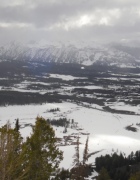
Since Scotty complained, let me start off by giving some info about good microbrews.  I’m currently in Bozeman and ate last night at Montana Ale Works.  They have an outstanding selection of microbrews and two recommendations I have are Moosedrool Ale and Bitter Root Nut Brown Ale.

Bison roaming freely on the plains and even the roads; wolves and a grizzly out looking for food; smoke billowing everywhere from the countless geysers;  Old Faithful faithfully shooting water and steam 100 ft+ into the air;

drive up bison; "i'll have buffalo wings"

drive up bison; "i'll have buffalo wings"

bison everywhere!

bison everywhere!

some of the park's many geysers

some of the park's many geysers

powerful rivers and waterfalls snaking every which way and plunging into deep canyons; lakes white with snow against a backdrop of lofty snow-capped mountains.  These are all the amazing sites I saw driving around Yellowstone in just 24 hours.  The park service has done a phenomenal job here making all the main attractions easily seen from your car or within a short walk of a parking area.  But if you truly want to experience Yellowstone, DO THE BACKCOUNTRY.  Amazingly, over 95% of Yellowstone is backcountry, yet the vast majority of visitors never make the effort to experience it.

My plan coming in was to do one night in the backcountry, but it took one minute of thought for me to add a night.  Might as well take advantage of the opportunity.  All overnight backcountry users must secure a permit (free) and watch a short video covering topics like “leave no trace” and “bear safety.”  Being spring, bears are very active.  Much of the bear safety stuff I’d heard before, but I picked up a couple new tips.  Though unlikely, if a bear does charge you, stand your ground cause it’s often a bluff charge and it’ll veer off or stop.  Though that’s the correct thing to do, can you imagine how f-ing scary that would be?  I’d be so tempted to run even though that’s the worst thing to do.  Secondly, sing, clap, or make noise in general as you approach blind spots to avoid surprising a bear.  The ranger put it best saying that he sometimes feels like an idiot constantly yelling, but he’d rather sound like an idiot than “not have a face.”

The itinerary was to enter and exit at points 20 miles apart by car, so I decided to leave my car at the Visitor’s Center, which was a good midpoint.  Plus, it’d be easier to hitch a ride from here with all the visitors coming through.  Sure enough, it took less than 5 minutes for a nice couple to stop.  They were traveling musicians who play folk and Celtic music and TOTAL hippies.

my hippie friends

my hippie friends (doesn't the dude look like Jerry Garcia?)

Their van had a fold out bed, peace necklaces, and lots of bumper stickers.  They’ve been on the road for 13 years with 5 weeks being the longest they’d stayed in one place!  Wow!  (Their group’s name is Four Shillings Short if you’re into folk and Celtic music).  They were wonderful people, but we arrived at the trailhead and it was time for me to go.

all this would be my playground

all this would be my playground; I'd pass four people the whole time out here

Before I could even set one foot on the trail, two bison came walking out.  Though they are quite docile, they can charge and at 2,000 pounds with speeds upwards of 30 mph, that’d be like getting hit by eight Ray Lewises with much faster speed.  I stepped a good ways to the side and gave the beasts their room.  After they passed, I was off.  But 15 minutes later, I had to let another bison pass (was forced to is more accurate).

letting it pass; like I have a choice

letting it pass; not like I had a choice

This would be a recurring situation.  Often they would just be chilling in the way of the trail and I would have to make this wide loop around them.  Most didn’t care for me but a few would stare me down as I went around, which was a bit nerve-racking.  I did consider running at them like a game of chicken figuring they might move, but if they weren’t chicken…I’d be a pancake.  Sometimes I’d stop and watch them appreciating how awesome it was to be so close to these animals in the wild.

My campsite the first night was only 4 miles in and I was within 1/2 mile going over these rocks when something stopped me cold.  In front of me was the carcass of an animal that had been picked completely clean.  The rangers warn you to get far away from fresh carcasses cause it can likely mean predators like bears are close by or even watching.  Luckily, this one was already picked clean so unlikely any predators were still around.  I think it was some sort of deer.

some animal loved it, i might as well gnaw on it

some animal loved it, i might as well gnaw on it

After setting up my camp which was next to Hellroaring Creek, I made my way down to the creek.  With the spring runoff, all the creeks might as well have been rivers as they were all full of water and flowing fast.  I spent the rest of the day hopping along the creek and loving every minute of it.

the raging creek

the raging creek

risking crossing it for no good reason other than the thrill

risking crossing it for no good reason other than the thrill

Having forgotten to bring any time telling device, I headed back to camp as the sun started to set.  With animals more active at night, I did not want to be out late.  Though it took me forever, I finally succeeded in securing my food high and away from a tree branch.  As I crawled into my tent, I thought how incredible it is that a thin piece of fabric makes me feel so much more secure.

The second day invovled a 9 1/2 mile hike to my next campground.  Like the first day, the scenery was beautiful and the bison roadblock and picked clean carcasses made their appearance every now and then.  My campsite this night was along the Yellowstone River and with it being warmer, I slept far better than the night before.  I woke up eager to complete the final 9 miles of my journey.  These 9 picturesque miles would follow the Yellowstone River the whole way taking you into Black Canyon.  A few miles in, I hit this very muddy area and completely lost the trail.  Knowing I’d just have to follow the river and would eventually pick it up, I scrambled down this rockslide towards the river.  As I landed on the sand, I looked down and “Shit!” (Yes, I did in fact yell it out).  Five feet from my foot was an untouched carcass of a mule deer.

the fresh carcass

the fresh carcass

Instinctively, I scrambled away from it looking for bear tracks.  Not seeing any, I took a deep breath and hurried by it – but not before stopping for a sec to take a picture :-)   Finding the trail again, I hiked the rest of the way without incident to my end destination – the town of Gardiner, MT, which is actually just outside the park.  (Interestingly, the route I took was right along the Wyoming/Montana border so I went back and forth between the states a couple times on the hike).  What a wonderful time!

I caught a ride back to the Visitor’s Center from a park ranger who stopped in town to grab lunch.  Back at my car, I unpacked then grabbed my wallet and made a straight line for the Mammoth Hotel next door, which offers showers for $3.25.  After eight consecutive days of camping/hiking, it was arguably the most worthwhile $3.25 I’ve ever spent.

Revising my itinerary, I decided to pass on the Crazy Mountains in Montana.  There’d be too much snow, but I wanted a couple days to relax anyway.  I’ve come to Bozeman instead, which is a fun place with a young college crowd (Montana State).  And after all the hiking detours the bison caused, it was only appropriate to have a bison burger washed down with the aforementioned delicious ale.

Random thought:  topo maps and iodine tablets are two of the best inventions ever.

Final comment:  Whether you drive around, do the backcountry, both or whatever, GO TO YELLOWSTONE!  It’s truly one of the world’s most special places.


It’s Not Just Potatoes

7 05 2009

(**Note** – All photos including ones of me were taken by yours truly.  Traveling solo has developed my skill of setting a camera on anything – tree branches, rocks, etc.  Also, local libraries are the way to go for free Internet)

It’s understandable if you thought the only thing noteworthy about Idaho was potatoes.  After all, Idahoans throw it right out there with the tagline “Famous Potatoes” on their license plates.  But, I always had a suspicion that there was much more to this state and though I spent far too short a time here, I’m hooked and will surely come again.

Sawtooth Region

Sawtooth Region

Highway 21 runs about 130 miles beginning in Boise and ends in the town of Stanley – right in the teeth of the Sawtooth (get it?) Recreation Area.  It’s a beautiful (and winding) drive.  Entering Stanley, the town sign tells you 100 people live here. (It does get touristy in the summer months).  But what the town lacks in population, it more than makes up for with its charm.

Stanley, Idaho

Stanley, Idaho

Entering Stanley is like stepping back in time.  Mountains, lakes, and rivers dominate the landscape, wildlife is ever present, and wood buildings and homes are the only kind.  Kids should send Flat Stanley here, and not only cause he shares the town’s name.

I’d come to Stanley for the scenery of course, but also with the plan to do the 10 mile round trip hike to Sawtooth Lake.  After a night of camping next to the Salmon River, I woke rearing to go.  I’d heard the road to the trailhead was closed due to snow, so I would need to hike a couple miles in first.  Armed with snowshoes (Ann Gaudard, you should be proud!) and a new pair of gaiters I bought, I felt ready despite the abundant amount of snow still present.  It didn’t take me long to realize that Sawtooth Lake was not a practical destination.  Even with snowshoes, I was potholing down over a foot regularly. It was exhausting and very time consuming just to reach the trailhead, which ended up being a good three miles away.  It didn’t help that hail/rain started falling right after I started.

if it hails, EAT IT!

if it hails, EAT IT!

In the end, I simply snowshoed around appreciating having the vast, gorgeous wilderness to myself.  Other than animal tracks, there was nothing.  I kept hoping to see a snow fox or the Abominable Snowman (or “Yeti” as I prefer to call it), but to no avail.  Fortunately, the local lodge in Stanley had coin-operated driers cause I was in need of one when I got back.  After drying my clothes and eating a good meal at the only open restaurant in town, I made the 1 1/2 hour drive to the Sun Valley area.

rockin' the good life in Sun Valley

rockin' the good life in Sun Valley

Sun Valley is a popular ski area with a yuppie vibe (and a good microbrewery by the way).  I checked my email in a local hotel lobby before heading out of town to camp for the night.  Talk about contrast – wi-fi to camping  in 10 minutes!  I had the entire campground to myself.  This isolated camping is becoming a common theme on this trip.  It doesn’t bother me (otherwise I wouldn’t do it), but if some crazy Blair Witch shit happens…

Craters of the Moon.  My last destination in Idaho is really a place you have to see for yourself, so I’ll keep it brief.  It’s like something straight out of Tim Burton’s mind.  The landscape is an eerie, endless sea of black volcanic rock.

crazy landscape of Craters

crazy landscape of Craters

The best part is that the park boasts several caves, which you are free to explore on your own!  Still low season for most parks, there was no one else around as I descended into five different caves.

licking icicles in the cold dark cave

licking icicles in the cold dark cave

Accompanied by my headlight and camera, I walked, hopped, climbed, and crawled through the caves occasionally wondering if the creatures from the movie The Descent would pop out at me.  (What’s with me and fictional monsters?)  It is an exhilarating experience to be underground, in total darkness by yourself.  I turned off my light a couple times and it’s PITCH BLACK.  You could stare forever and still only see black.

And with that, Idaho is done, for now.  Now it’s off to our country’s most famous and touristy park – Yellowstone.  It is still low season as I mentioned though, so maybe it won’t be too bad.


Small Towns, Wild Refuge, and One Hip City

4 05 2009
first night's "hotel" location

first night's "hotel" location

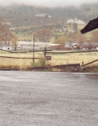
850 miles (much of it very scenic) and 16 hours on the road has landed me in Boise, which I learned is pronounced Boi-C and not Boi-Z.  My destination the first day was Lakeview, Oregon – a tiny town in the SE corner of the state just past the border of California.

Lakeview boasts a White Settlement Rd.  I looked but didn’t see any black, brown, red, or yellow settlement roads.p5030051 My plan was to camp, but was considering alternatives given the rainy weather though I had no intention of dropping $40+ for a room.  Asking a local, I found out about this RV park and motel down the road.  Using my wonderful charm, the nice lady generously agreed to let me use her parking lot to sleep in my car.

After a surprising decent night of sleep, I woke to find my windows completely fogged up.  It reminded me of those serious alpinists sleeping in snow holes…with one major difference.  There would be no digging out for me.  I only had to muster up the strength to turn a key and hit the defrost button, which worked like magic!  Wasting no time, I hit the road eating healthy Pop-Tarts (it has fruit – blueberry) for breakfast.  Along the way, I pulled off to check out Lake Abert and the adjacent Abert Rim, which is “one of the highest fault scraps in the United States” though I’ll admit I really don’t know what that means.  I passed small town after small town though I don’t think it’s accurate to call them towns.  One in particular made me laugh.  I think Wagonwheel was the name.  I saw a Wagonwheel sign as I entered the “town” and less than ten seconds later, I passed a sign that said, “Thanks for visiting Wagonwheel!”

Halfway to Boise, I visited Malheur National Wildlife Refuge.  There’s not much to it unless you’re an avid bird watcher, which I am not.  It is kind of cool simply because it’s a MASSIVE expanse of land and prone to sudden weather changes, which I got to experience first hand.  Driving into the refuge, I was blitzed by the hardest, heaviest hail I’ve ever been in.  Less then ten minutes later, I was in sunny weather.  Shortly after, I got out to walk a very short trail to this overlook.  After a couple pictures, I noticed a wall of dark clouds nearly on top of me and said to myself, “I’m about to get blasted.”  Sure enough, not even one step towards my car, it was on me.  I sprinted to the car and luckily avoided the worst of it.

Deciding I had enough adventure for one day, I drove straight to Boise.

standing by the welcome to Idaho sign

standing by the welcome to Idaho sign

Thanks to Let’s Go!, I found this great little hostel just outside the city for $19 (it’s really a house).  I’ve been in hostels all over the world, but first time in the US.  From parking lot to a house, I’m moving up in this world!  In the evening, I headed to downtown Boise, which is such a cute place.

downtown Boise

downtown Boise

I saw the (in)famous blue turf of Boise State’s Stadium then had a pint of Pilsner Urquell at a gay bar.  In case you’re wondering, I read it was “gay friendly” beforehand, but it’s supposed to be a good bar, so I figured why not?  I proceeded to also get worked at pool by the gay bartender.  He was damn good.  I actually played really well, but not much you can do when he sinks all his balls in two turns (I’m sure many of you are thinking of dirty, childish jokes).  To be fair, I did too as I wrote it.

Hopefully, the weather cooperates the rest of the week as I’m planning to head to the beautiful Sawtooth Region of Idaho to do some hiking the next couple days.  It’s likely I’ll be moving back down in this world as I plan to camp.  Weather report says the low will feel like 18…brrrr.  Just give me no rain and I’ll deal with the cold.


Final Prep for 4,000 Miles in 4 Weeks

30 04 2009

In a couple days, I’ll be on my way.  Sure, 4,000 miles in 4 weeks isn’t anything impressive.  That’s a measly 143 miles per day.  If I could morph into the Energizer Bunny – going, and going, and going – Google Maps says I could make my cross-country drive in 2 days 19 hours.  But like the fabled tortoise, “slow and steady” is the key here.  Usually, I find the “slow and steady wins the race” moral to be a whole lot of BS cause if you think about it, clearly “fast and steady” wins the race.  This not being a race though, I’m down with slow and steady.

my planned route

my planned route

dsc00562

on top of Moro Rock

I’ve bounced around quite a bit in my life, but I still always feel a little sentimental leaving a place.  It’s only natural.  I’ll certainly miss the beauty of the Bay.  It’s not everywhere that I can drive 10 minutes and be standing in the waters of the Pacific, make a day trip and ski at Tahoe, and take off for a weekend to hike Half Dome.

Standing on top of Moro Rock earlier this week at Sequoia National Park with the Sierras around me, I thought to myself, “I’m really going to miss this.”  But, the great part is that there are always more adventures ahead and 4,000 miles in 4 weeks will certainly be full of them.  Who knows what interesting folks I’ll meet and amazing places I’ll see.  While no set itinerary is the way to go, I’ve definitely got some places on my radar:  Sawtooth Lake (Idaho), Yellowstone and Big Horn Mountains (Wyoming), Crazy Mountains (Montana), and Mt. Rushmore, Wind Cave, and Badlands (South Dakota) to name a few.  Though I’m going with a nature theme, I’m excited for the fun cities I’m sure to pass through as well.

A recent funny story got me thinking that perhaps I should adopt a new identity for this trip much like Chris McCandless became Alex Supertramp in Into the Wild.  The story goes that a project manager with KaBOOM! had problems with his work cell phone, so he was given my old one which still had my recorded voicemail on it.  When one of his community contacts called him on this new number, the contact got my old voicemail and was understandably perplexed.  Later, the contact tried to explain the voicemail to the project manager and said, “It was like…Fung Lee.”  I understand that Bing Wu is not the most common name, but Fung Lee?  Bing Wu and Fung Lee sound about as similar as Barack Obama and Flavor Flav.barack-obamaflavorflajp_yimzumanewscom Maybe I’ve got it all wrong though.  Maybe I need to embrace this alter ego and retitle this blog The Adventures of Fung Lee!  But, come to think of it, while I love adventure, I’m not quite the wandering romantic McCandless was.  Plus, I rather like my name, so I think I’ll stay with Bing Wu.


Follow

Get every new post delivered to your Inbox.